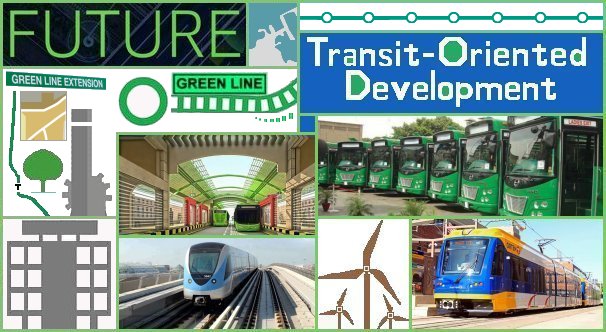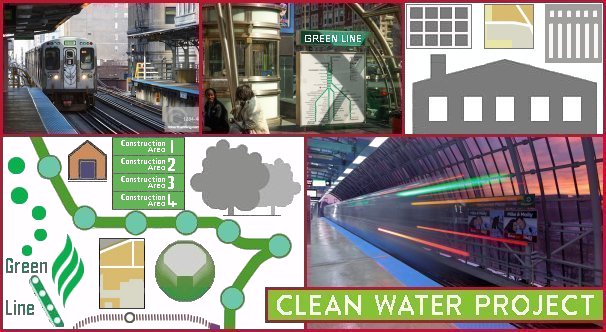
Officials have the experience that the main objective of a Transit-Oriented Development (TOD) with Privately Owned Public Spaces (POPS), Light Rail Transit (LRT), and Bus Rapid Transit (BRT) lines should be to bring the community together; a TOD is also known as a Green Line Development. The Green Line Park Corridor (the USA Twin Cities Green Line) is a light rail line that connects Minneapolis and Saint Paul. As transit regulates how people live and work, the Saint Paul Trust for Public Land is delegated to provide high-quality open spaces to improve the quality of life of the community. The private and public sectors have assisted by investing in green space projects such as parks, parklets, gardens, and plazas along the Green Line to develop the social, economic, and environmental sustainability of the city. The closer public parks are to open spaces the more the likelihood of increased property prices and developmental projects.
Saint Paul (the capital of Minnesota) is a prosperous commercial centre with large regional enterprises and professional firms as well as commercial, educational, manufacturing, transportation, and non-profit organisations and institutions. More than 80 languages are spoken in public schools. Saint Paul’s neighbourhoods have a strong character of culture, ethnic heritage, tradition, and diversity; the continued development of Downtown serves as commitment to preserve diversity. Saint Paul has more city shoreline on the Mississippi River than any other city. The riverfront (the most desirable neighbourhood) is where to live, learn, work, and relax. Large-scale creative developments such as the Central Corridor that will link East Metro with Metro Core to integrate neighbourhood norms underlines why Saint Paul is America’s cultural and historical city and seat of government for Minnesota. Summit Avenue (the longest preserved Victorian Avenue in the country) is home to the Governor’s Residence; authors F. Scott Fitzgerald and Sinclair Lewis both lived in Summit Avenue. Donated to the city in 1909, Dickerman Park is located along University Avenue between Fairview Avenue and Aldine Street. Saint Paul is helping with the park’s original vision by developing a practical design as well as adding new walkways, planting areas, plaza spaces, and public art to the Green Line. A design advisory committee has been appointed to judge whether public interest is included in the final project design. Little Mekong Plaza (near Mai Village) is a lively new privately owned public plaza on University Avenue (close to Western Avenue North). Infusing Saint Paul’s principles to create vibrant open spaces, the plaza hosts various public events to attract residents and visitors. Little Mekong Plaza represents Hmong, Vietnamese, as well as other ethnic and immigrant communities that have businesses (and live in the area) and establishes an Asian cultural corridor in the neighbourhood. The Hmong American Partnership (HAP) owns Little Mekong Plaza. HAP organises maintenance and programming in collaboration with the Asian Economic Development Association and other community partners. The City of Saint Paul provided the owners grant funding and technical assistance with design, ordinances, and review processes.
The vision for the Park Green Line transit corridor is for parks and open spaces to be integrated into the transit line to encourage new developments, serve the population, and strengthen the economy. The percentage of park land around the Mississippi River is a substantial portion of the corridor; leaving the Saint Paul segment of the Green Line with less park land. Minneapolis Park and Recreation Board and Saint Paul’s Park and Recreation Department manage their parks as an integrated system and collaborate about connectivity between public parks and neighbourhoods. To agree on POPS next to the corridor, Minneapolis and Saint Paul need to support the development of POPS in different market areas; firstly, in the Midway Central, Midway East, and Midway West areas, secondly, in Downtown Saint Paul and the University and Environs areas, and thirdly, in the Downtown Minneapolis area. Saint Paul’s Parks System Plan promotes POPS as a feature of new developments in the Green Line corridor. The challenge of the Green Line Parks and Commons is to ‘Green the Line’ with the vision to connect an integrative system of parks and other privately owned open spaces (on condition that these spaces would be available to the public); to reach this goal, the private and public sectors have a joint liability to ‘green’ the Green Line. The vision includes firstly the private sector’s responsibility when limited municipal resources are available. Distinguishing parks as a ‘system’ is not a recent innovation; the validity of the innovation is to expand the park system by incorporating POPS; re-development and improvement in the Green Line corridor by including a connected system of new privately owned (publicly available) parks and open spaces. Secondly, parks and open spaces with advantageous proximities for new developments are intermediary beacons for further developments; natural areas, parks, and trails. Thirdly, the Green Line system should purposefully work towards locating parks and open spaces to serve and provide stability to the neighbourhoods (to best meet the needs of the community). Lastly, the parks and open spaces should lead to an entrance into the Green Line, amenities for residents and workers, improvement of TOD real estate values, the prospect of trade names for the corridor as well as the neighbourhoods, and the right of admission to underserved groups.
Employees, residents, and transit riders experience that the parks and commons in the Green Line corridor are not attached and do not belong to an integrated park and open space system as is the scenario in other parts of the metropolitan area. It must be remembered that the Green Line corridor project is not an overnight vision and will take time to implement. Given the magnitude of parks and commons in the corridor, it is important to realise that such an enormous project qualifies as a long-term goal; therefore, it involves long-term planning and re-development (a period of twenty years in different phases) to incorporate parks and commons, and finally a well-connected system. Leaders from different departments have to come together, assess new approaches, and reinforce partnerships with the communities to accomplish the vision. The Green Line Parks and Commons outlined main responsibilities for the private and public sectors to benefit from a joint system of parks and POPS in the six subareas of the Green Line corridor namely city and public leaders should pursue a leadership role, park representatives and public agencies need to work in partnership with developers and pool resources when developing public parks, private and public partners should participate in the maintenance and programming of parks and POPS, and developers need to prioritise the integration of POPS into present and future developments. With the compound goals for parks and POPS, open spaces must be allocated between the six subareas. The quality of open spaces is more important than the amount of open spaces. The significance of pre-planning to secure investment and encourage development must include consideration of the locations of the sites and the designs of the amenities. Each subarea requires one or two public parks and at least one high quality (very visible) POPS.
Caring for existing public parks involve adequate maintenance and economic support. One of many major obstructions of developing new public parks is limited municipal resources; therefore, it is essential to consider new methods of financial support. Investment is required to maintain existing public parks and increase the momentum, potential, and recommendation of public parks. The Trust for Public Land observes various park contribution approaches across the country such as involved citizens who voluntarily clean up parks, ‘Friends of” groups (from loose structures to formal non-profits) who raise funds for a park or various parks, as well as Park Conservancy groups (a transformed ‘Friends of” group or a recently formed group) that manage a new park, a re-development of an existing park, or fund crusades towards a new park. All over the country, various ‘friends of’ and ‘park partnership’ groups have acknowledged the necessity and responsibility of fundraising to maintain parks. Community groups and local leaders are in the position to assist cities in converting urban neighbourhood and downtown parks into active hubs. The scope of actions that can be upheld by park contribution partnerships are regular maintenance, designing, planning and building of developmental assets, restorative maintenance, security and safety measures, fundraising, advertising and reaching out to the public, recruiting volunteers, and supporting the vision on behalf of others. Although maintained by a landowner (generally a private owner), privately owned public spaces (POPS) are outdoor facilities meant for public use. Excluding parks departments, POPS can also be owned by public entities.
In reality, (POPS) are suitable for various surroundings such as urban hubs and transport nodes. They are planned to offer air, freedom of breathing, light, and open space to ease the discomfort of crowded areas. Open spaces are not required to be big, ‘green’, or publicly owned to be valuable to residents, transit riders, and workers. POPS can be structured as atriums, covered pedestrian spaces, gardens, terraces, urban plazas, and small parks that have practical and visual facilities such as plants and seating for the public to enjoy. Various cities in the United States are aware that different approaches to POPS can generate substantial value to cities and residents. One such approach is to create motivation programs to boost the private sector’s awareness of any improvement in POPS.
Runoff from storm water is a persistent source of water pollution in urban areas. It transmits waste, bacteria, heavy metals, and other impurities from storm sewers into water catchment areas such as rivers and dams. Heavy rainstorms destroy property, damage infrastructure, and cause flooding. Traditionally, communities used gray infrastructure (gutters, tunnels, and underground pipe networks) to move storm water away from living environments. In many neighbourhoods across the country, there is a decline in the ability of gray infrastructure to handle large amounts of storm water. To solve the situation, several communities have installed green infrastructure (GI) systems to manage storm water drainage (resulting in social, environmental, and economic advantages). GI is defined in the United States Water Infrastructure Improvement Act as ‘the range of measures that use plant or soil systems, permeable pavement or other permeable surfaces or substrates, storm water harvest and reuse, or landscaping to store, infiltrate, or evapotranspirate storm water and reduce flows to sewer systems or to surface waters.’ Storm water management remains a major challenge to several cities. The United States Environmental Protection Agency (EPA) researches storm water management to help communities manage storm water, use storm water to supplement water resources, manage the quality and quantity of storm water, and to reduce joint sewer overflows. Green Infrastructure is a cost effective approach to managing storm water that provides many social, economic, and environmental benefits such as improved surface water quality, community safety, and water conservation.
Green infrastructure lessens or avoids the extent of water that flows into storm water drains which is useful to cities with joint sewer overflows and nutrient setbacks. GI includes several water management methods such as absorbent gardens, vegetated rooftops, and other methods to capture, filter, and reduce storm water. Successfully managing urban storm water with GI systems offer several positive attributes to urban areas and communities such as absorption of carbon, cleaner air and water, prominent green spaces, wildlife habitat, flood protection, and increased economic value. Altered dimensions of green infrastructure can be combined into a community. Urban level examples are greening an alley, a rain barrel next to a house, or a row of trees beside a major city street. The neighbourhood level includes considerable open park space outside a city centre, creating a wetland close to a residential housing complex, or planting rain gardens. The landscape or watershed level consists of greening steep hillsides, sheltering large open natural spaces, or wetlands. The city of St. Paul, Minnesota is changing its approach to storm water management in collaboration with the University of Minnesota by means of private-public partnerships and green infrastructure. GI programs often result from federal requirements; however, St. Paul’s sewer systems comply with federal code and do not need change. Using storm water as a resource is a voluntary choice of the residents of St. Paul and serves as a future investment. MetroLab’s Executive Director (Ben Levine) asked St. Paul’s water resource coordinator (Wes Saunders-Pearce) about the city’s plan to modernise the storm water infrastructure. Summarised, Saunders-Pearce’s explanation was that green infrastructure is a storm water management approach that uses natural landscape aspects to treat storm water to preserve or restore natural hydrology. Also, that GI uses soils, vegetation, and other elements and practices to restore some of the natural processes needed to manage water and establish healthier urban environments. He added that large-scale green infrastructure systems help to improve air quality and reduce urban heat stress, thereby addressing the environmental impact of climate change on populations. Due to on-site management and underground technological approaches most of the storm water in new developments in Minneapolis and Saint Paul abide by the norm that storm water excess should be managed on the premises itself.
‘Shared’ refers to storm water management situations where GI supplies treatment to more than one plot (private or public). The National Public Transportation (Transit-Oriented Development Technical Assistance Initiative) is a project of The Federal Transit Administration administered by Smart Growth America that researches storm water management solutions for Transit Oriented Developments; storm water runoff from multiple plots (joint) in shared green infrastructure known as ‘stacked-function.’


